Port & logistics corridors
Port Chancay and Pacific infrastructure under recurring aerial survey — progress tracking and encroachment alerts.
INFRASTRUCTURE WATCH
DAI-ATLAS coordinates weekly VTOL DAI-UAV coverage of ports, highways, bridges, and transmission corridors — fused with satellite baselines for change detection and institutional reporting.
Port Chancay and Pacific infrastructure under recurring aerial survey — progress tracking and encroachment alerts.
Power-line inspection across Andean terrain — SAR-backed geohazard intelligence for lines crossing canyons and complex geology.
Road, rail, and bridge construction monitored with orthophoto timelines and volumetric cut/fill analysis.
Schedule an infrastructure watch briefing for your port, corridor, or megaproject.
Request demoSatellite Andes baseline plus VTOL DAI-UAV field collection — hover each sector to see field video. DAI-ATLAS calculates outputs for agriculture, mining, security, and energy.
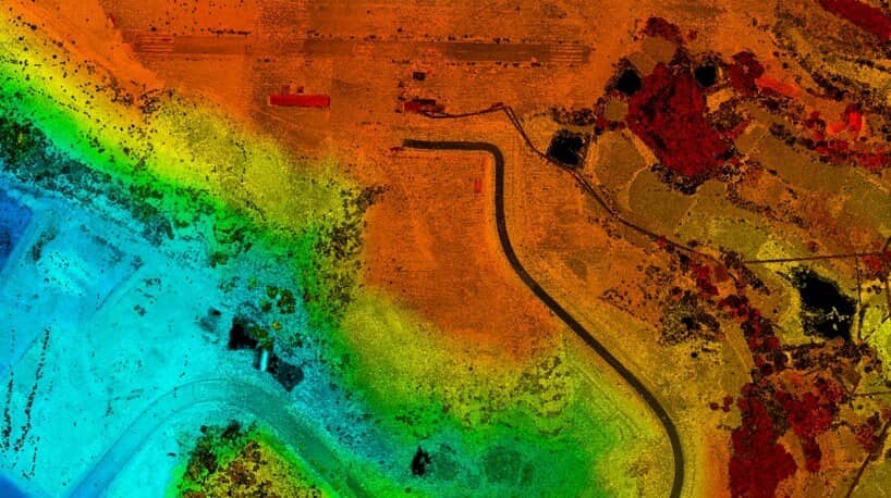
Orbital baselines fused with RTK orthophotos, oblique imagery, and LiDAR — large-scale mapping across the Peruvian Andes with survey-grade deliverables in 24 hours.
Learn More