Agentic AI
DAI territorial agent
Like ChatGPT, but for your territory.
TECHNOLOGY · GEOSPATIAL · AI
Anyone can build drones. We innovate where it matters: the software layer that fuses satellite, sensors, maps and AI agents — and turns territory into traceable decisions.
We integrate whatever hardware you choose when needed. Our product is DAI-ATLAS: geospatial + AI platform, deployable sovereignly.
Our IP is fusion, agents and predictive analytics — not assembling aircraft.
Data under your control, on-prem or national cloud, evidence for institutional audit.
We connect public satellite, legacy sensors and any OEM fleet — you choose; we operate.
Same DAI-ATLAS platform, different analysis logic per industry — explained in video, not hardware brochures.
Like ChatGPT, but for your territory.
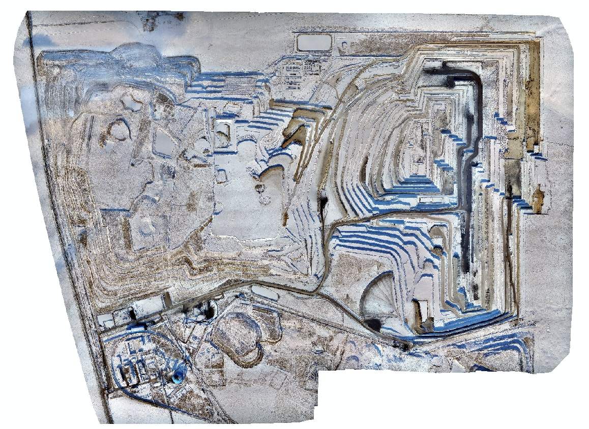
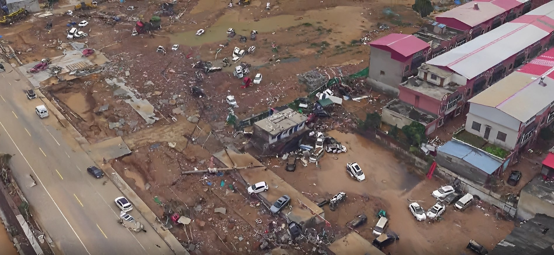
See every pit, tailings dam and illegal frontier — before the problem.
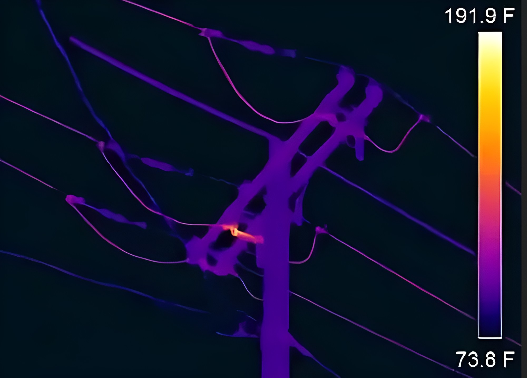
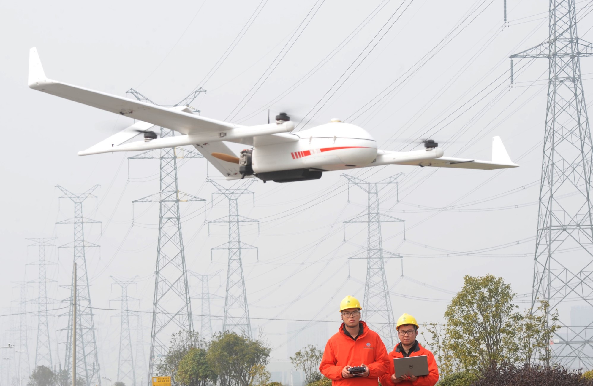
Grid reliability without setting foot in the field.
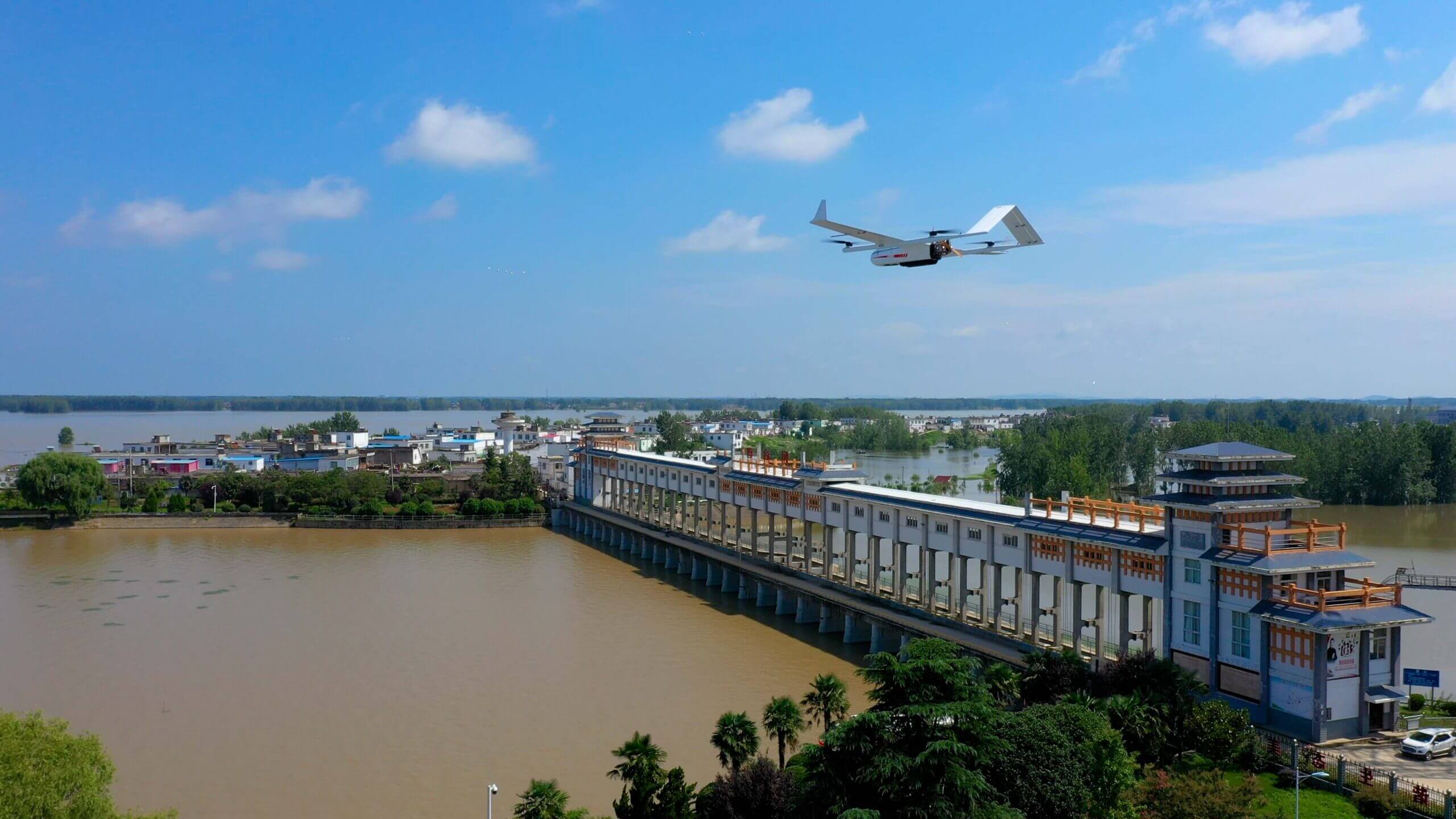
From glacier to reservoir: manage every drop.
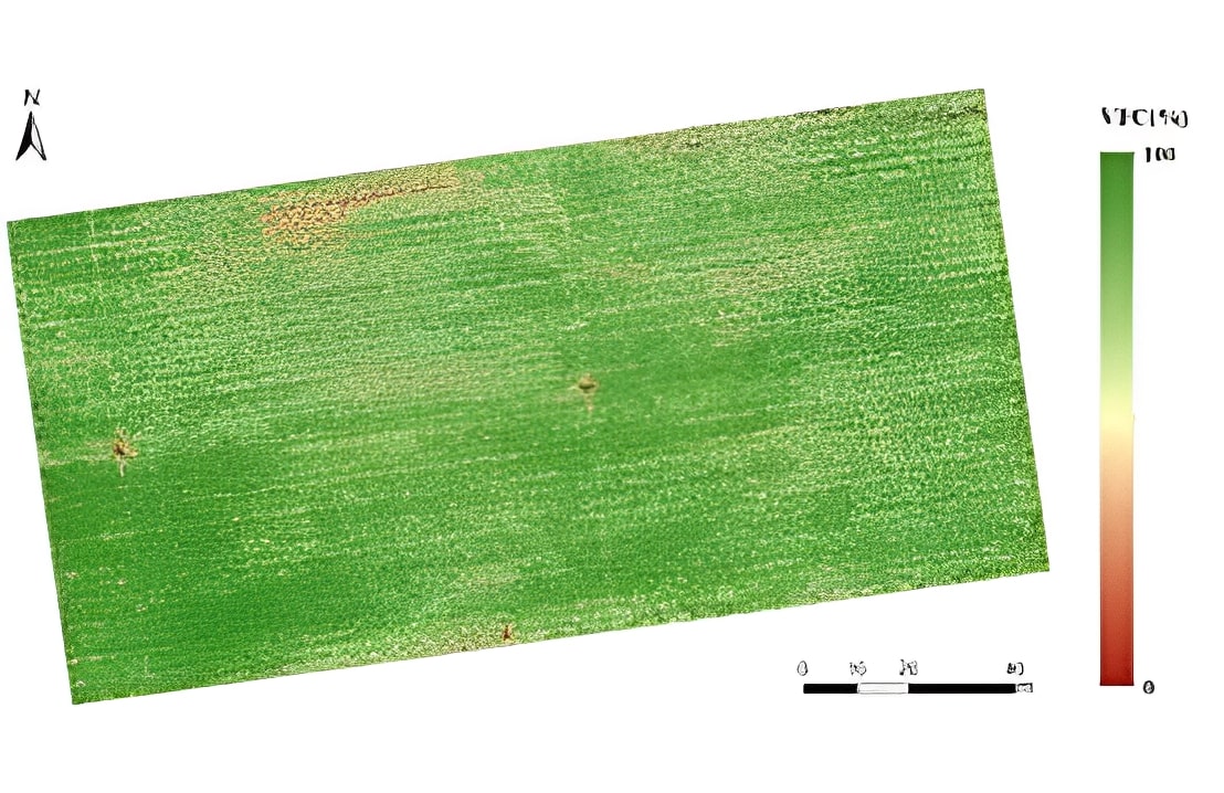
Every hectare measured. Every stress detected.
The Amazon watched in near-real-time.
DAI-ATLAS: comprehensive geospatial platform
Like industry leaders — Esri ArcGIS, Google Geospatial Analytics, NV5 Geospatial — DAI-ATLAS integrates data through geographic context: satellite, sensors, analytics and AI on one sovereign operating map for Peru and Latam.
Satellite fusion, revisit, SAR and change detection — the geospatial base of the system.
Aerial telemetry, field sensors and third-party feeds — any source, one data model.
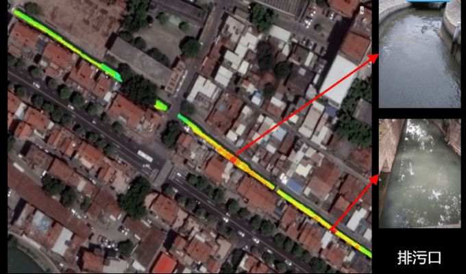
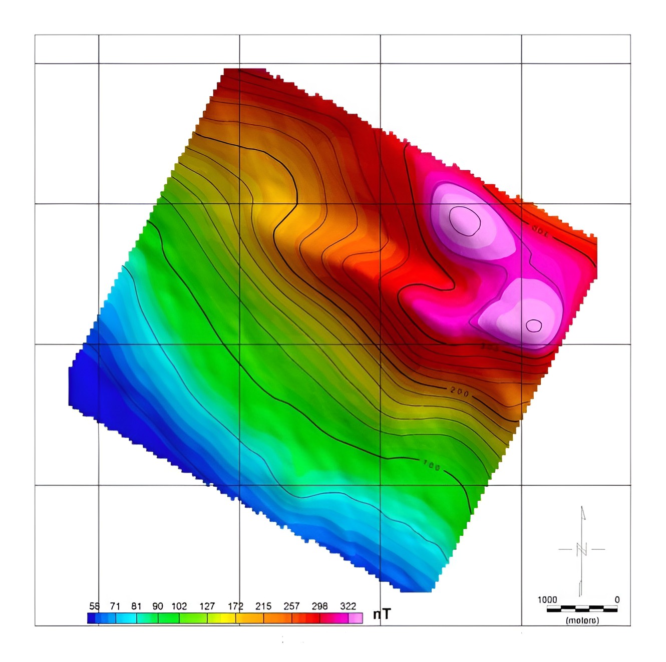
Derived layers, indices, risk scores and automated detection — AI on territory, not marketing.
AI agents, alerts, cited reports and common operational picture — from pixel to institutional action.
From launch momentum to mining camp — one territorial stack
Watch launchPeru · orbital era · institutional
DAI-ATLAS · SpaceX · Grok · Cursor · Peru 2026As Peru advances its strategic alliance with the United States and northern launch infrastructure, DAI connects orbital momentum to the field: LEO uplink gate, VTOL sync, and sovereign DAI-ATLAS delivery for mining, agro, and defense-grade programs.
LEO field uplink · LiDAR & orthophoto sync · pit volumes & NDVI · sovereign DAI-ATLAS API.
Starlink LEO broadband is the field uplink layer DAI-LINK monitors before LiDAR and orthophoto sync — mining, agro, petro, and water across remote Andes.
Explore Starlink ↗Reusable launch cadence and orbital infrastructure set the rhythm for Peru's strategic alliance — DAI connects that momentum to sovereign DAI-ATLAS delivery.
Learn more →Not marketing drones — a sovereign stack: uplink gate, Atlas Vision, Grok interpretation, and institutional API on one map.
Explore stack →VTOL and sensors sync only when DAI clears the uplink. Atlas Vision interprets frames. DAI-ATLAS publishes institutional outputs.
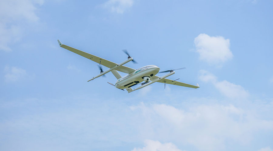
VTOL · LiDAR · IoT at 5,000 m
DAI-LINK health · sync clearance
Entities · tasks · objects API

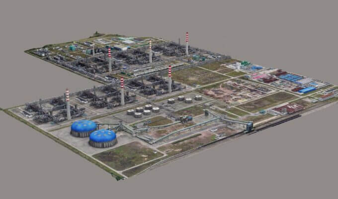
Pit volumes · NDVI · change detection
Edge agent on camp LAN monitors Starlink health. DAI clears or holds LiDAR and orthophoto sync before publish — mining, agro, petro, water across remote Andes.
mining · agro · petro · waterGrok Vision interprets satellite, VTOL, and pit frames — crop health, infrastructure inspection, terrain risk, and change detection fused into DAI-ATLAS reports.
satellite · drone · VTOL orthophotoCursor Teams powers DAI squad delivery — sovereign Atlas repo, Cloudflare edge, Supabase PostGIS, and agentic QA for institutional Peru programs.
Atlas · API · edge · RLSInstitutional pathways and strategic cooperation — full detail on Territorial Stack. Starlink and launch references belong to Space Exploration Technologies Corp. DAI integrates field orchestration — not a SpaceX product. SpaceX (spacex.com).
Planetary-scale analytics power — public feeds, satellite revisit and sovereign AI over your area of interest in Peru (Google Geospatial Analytics / Earth Engine pattern).
NV5 pattern: actionable geospatial data for infrastructure, energy, natural resources and software — not a drone catalog.
Institutions in Peru that need geospatial + AI intelligence — not more hardware brochures.
Geospatial inspection of lines, substations and transport corridors — change detection, thermography and alerts before failure. Civil and industrial operators on the same platform.
See infrastructure →We don't sell images. We run a closed loop: observe the territory, understand it and act — then start again, at the pace of change. Sovereign, inside your institution.
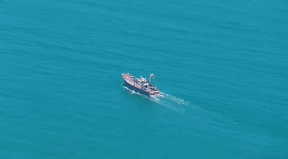
We fuse satellite, drone and field sensor — space, air and ground — onto a single ground truth of the terrain.
AI and cloud turn millions of pixels into actionable signals: change, risk, opportunity.
DAI-ATLAS brings it together into a common operating picture — one living map shared by ministries, operators and civil institutions.
Alert, deployment, enforcement or policy. The decision executes and writes back to the system — the loop closes and learns.
Observe · Decide · Act · Repeat — without depending on a foreign vendor.
Earth observation sounds complex. We explain it in plain language, so your institution decides on merit — not on faith.
Capturing information from a distance. Satellites and drones detect the energy the terrain reflects or emits, without setting foot there.
How often a satellite looks at the same spot again. It sets whether we see a change daily, weekly or live with drones.
Four kinds: spatial (how fine), spectral (how many colors), temporal (how often) and radiometric (how many shades). Together they decide what can be detected.
An optical sensor sees like a camera: it needs light and clear skies. Radar emits its own signal and does not depend on the sun.
DAI GUIDE · START HERE
Sovereign geospatial AI: platform, sectors, and orbital stack — start with the chapter that fits you.
Suggested reading order
Mission, institutional operators, and how to request a demo or join the Peru Program.
Satellite → field → desk: the territorial stack linking orbit, VTOL, and DAI-ATLAS.
Authorized OEM platforms built to order — mission sensors fused in DAI-ATLAS, not camera retail.
Risk scoring, critical infrastructure watch, and territorial intelligence layers.
Mining, energy, surveillance, emergencies — same data, different institutional deliverables.
No. DAI-ATLAS is the desk that connects your drones, cameras and sensors from different brands on one map — with no vendor lock-in.
Yes. Atlas fuses your information with satellite, sensor and context layers, all under your control and with full traceability.
No. DAI prioritizes free public data and your existing equipment. You pay for the intelligence, not the infrastructure.
No. Sovereign deployment in cloud or on-premise, with legal basis and an evidence trail for institutional review.
Institutional geospatial + AI platform demo — mining, energy, agriculture, infrastructure and industry across Peru and Latam.